By Elijah Polance
UConn Journalism
Drivers passing through Wethersfield on I‑91 South have probably seen the large body of water that fills the landscape on the right. Wethersfield Cove, the familiar but sometimes overlooked natural companion of the highway, is one of 143 tributaries to the Connecticut River.
During warmer months, the area is popular for walkers, fishing and boating enthusiasts, making use of the lengthy dock. During winter, when a layer of ice covers the calm water, devotees can be found standing on the surface of the water, fishing through holes in the fractal structure.
An abundance of fish, birds and plant life contribute to the vibrant ecosystem of the cove. A walk along the sandy shore or by Folly Brook, the canal that connects the cove to the Connecticut River, reveals great blue herons searching for a meal.
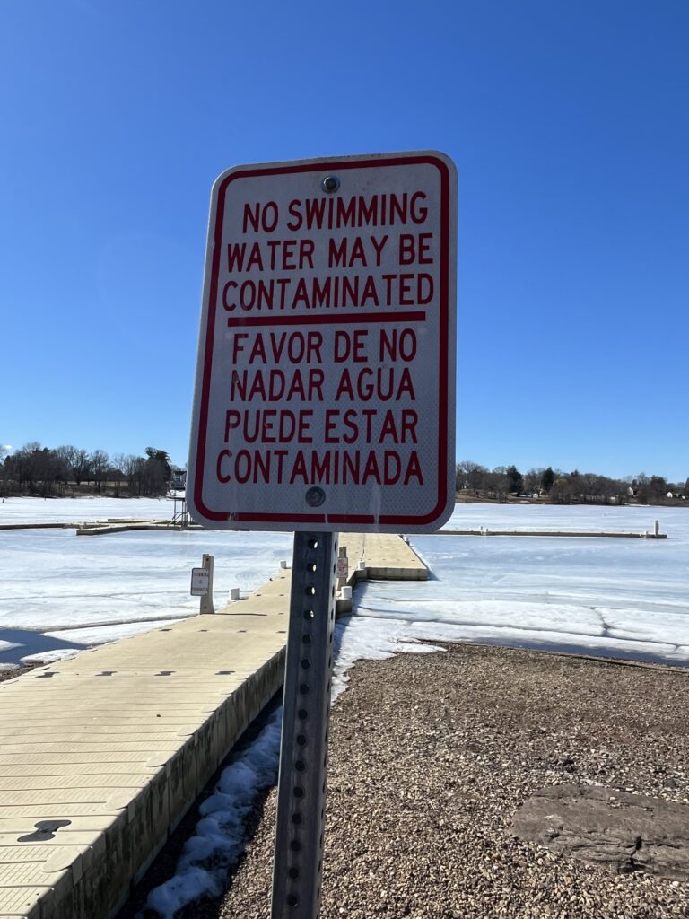
But “No Swimming” signs near the parking lot and occasional shutdowns of the cove after heavy rainfall tell a different story that has plagued the area for many years.
According to the consent order agreement between the Connecticut Department of Energy and Environmental Protection (DEEP) and the Metropolitan District Commission (MDC), combined sewer systems in southern Hartford overflow into Wethersfield Cove. As of 2020, there are 7 overflow sites at the cove. The sewage can dissipate through the cove or enter the Connecticut River through Folly Brook.
The structure of Wethersfield Cove amplified the problems of waste entering it, said Michael Dietz, the director of the Connecticut Institute of Water Resources at the University of Connecticut.
The cove is fed by Folly Brook and the current moves through the wide part of the cove toward a narrow inlet that runs underneath I‑91, entering the main stem of the Connecticut River by a narrow inlet. “So there’s very little flushing that takes place because of that narrow entrance,” Dietz said.
When sewage overflows into the cove, it can take time for it to leave. Not only does it pollute Wethersfield Cove, but the eventual flushing can make the area of the Connecticut River that connects to Folly Brook a risk to swim in.
Dietz pointed out that residents near Wethersfield Cove have had to face sewage backflowing into their homes, flooding basements.
“During CSO events, even with small amounts of rain, like half an inch of rain, people’s basements were backing up with sewage,” Dietz said.
The MDC has a plan to stop the flooding into the cove and of the houses near the cove: the South Hartford Conveyance and Storage Tunnel, now planned to operate by the summer of 2026. Upon completion, the four-mile- long tunnel will hold back excess stormwater and wastewater in southern Hartford that would have overflowed into Folley Brook and Wethersfield Cove. By the terms of a consent order between the MDC and the state of Connecticut, the tunnel aims to eliminate all remaining CSOs towards Wethersfield Cove and Folly Brook.

CSOs are not the only pollution threat to the cove’s health. Pollutants that run over roads, including garbage and fertilizers, can also enter the water. Additionally, a 2011 study by Johann Varekamp of Wesleyan University documented large amounts of mercury in the water from hundreds of years of industrial discharges.
Mike Ozmian, a Newington resident and a harbor master for Wethersfield, said that when the cove level rises during heavy storms, boaters are at risk. The water can also flood the parking lot, damaging parked vehicles.
“Flooding and the breeze, when the water gets high, collects trees off the shore and breaks it down into the channel and into the river,” Ozmian said.
But he said he has some reservations about the water quality. “I would not swim in the cove [or Connecticut River] until Glastonbury, which is not far from the cove,” Ozmian said. Glastonbury is less than two miles south of Wethersfield Cove.
Rhea Drozdenko, a river steward at the Connecticut River Conservancy, said Wethersfield Cove is a much healthier body of water than it was 50 years ago, before the federal Clean Water Act. She said that back then, runoff and CSO pollution were more prevalent, but now the water is mostly healthy.
“I find when I talk to folks from Wethersfield Cove, there’s this perception that the cove is just dirty, it’s unsafe to be in, and yet we do weekly water testing there and in general, Wethersfield Cove—unless it’s flooded—is safe enough for both swimming and boating,” Drozdenko said.
One of the ways the Connecticut River Conservancy has connected people with Wethersfield Cove is through its “Compass Youth Collaborative Paddle,” an event held with Compass Youth Collaborative, a Hartford organization working to help young people transition into adulthood through kayaking lessons.
“We really advocate for, you know, the responsible use of the Connecticut River and making sure that communities do feel connected, especially if they’ve historically felt disconnected,” Drozdenko said.
According to water tests from the Connecticut River Conservancy, which occur weekly from June to August, there was one test in 2024 and one test in 2023 that showed Wethersfield Cove was not safe for swimming.
In 2022, it was unsafe for swimming or boating on two days. In 2021, there were four days where the water was not safe for swimming and two days where the water was not safe for swimming or boating. Tests showing unsafe water often correlate with rain—but not always.
Drozdenko said water safety is evaluated by the concentration of E. coli bacteria in the water. E. coli is present in sewage because of human waste and agricultural runoff from manure. High E. coli concentration implies the presence of these pollutants in water.
Ozmian is optimistic about the gradual decline of CSO shutdowns and flooding issues involving Wethersfield Cove and nearby residents. He believes Wethersfield Cove is a valuable location for people living nearby.
“It’s a great place to go down there, especially with the kids,” Ozmian said. “Going out to boat with families, it’s a nice, central location.”
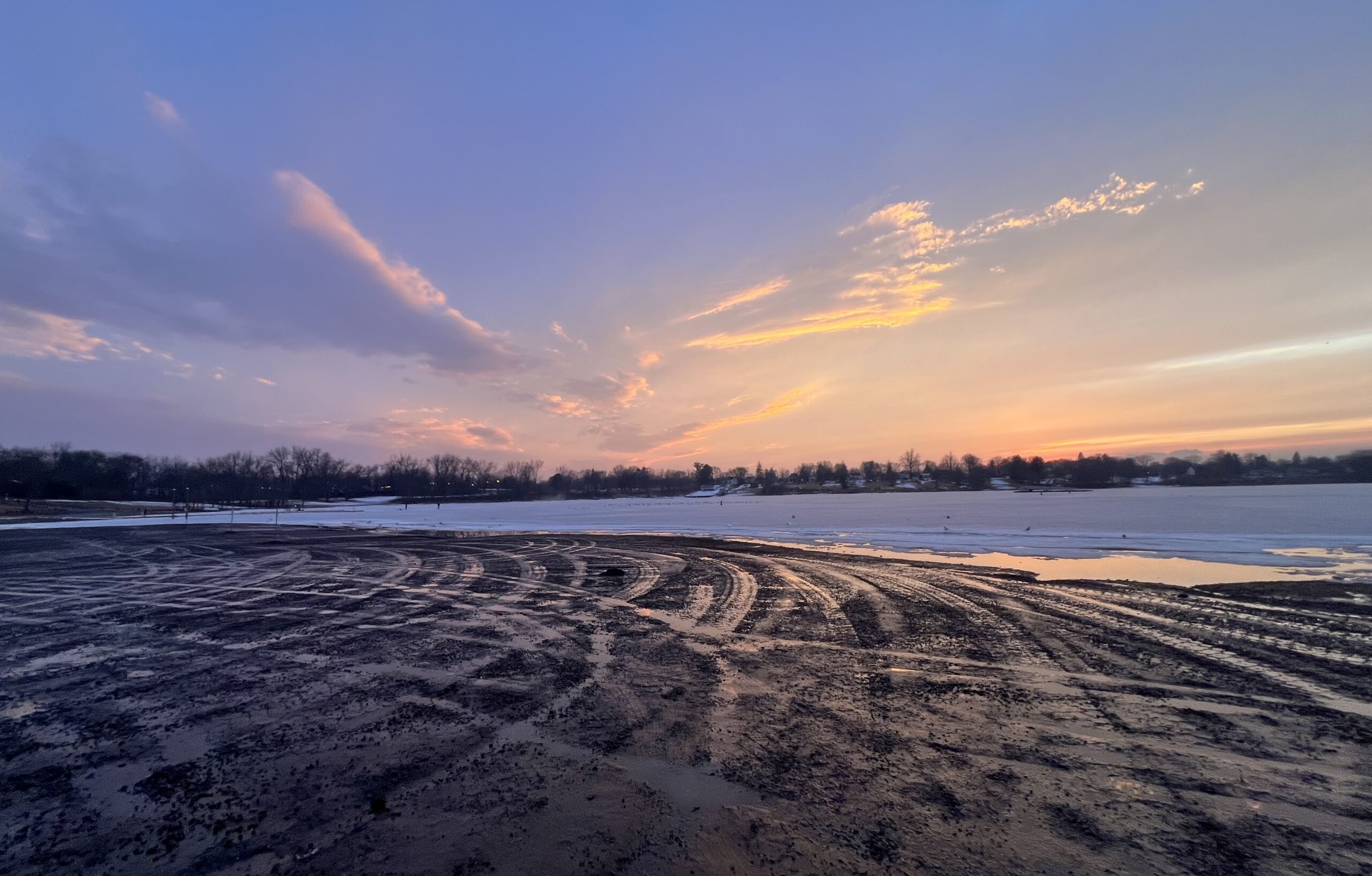
TOP IMAGE: Wethersfield Cove at sunset on a late winter’s day. Photo by Christine Woodside
SOURCES
Study by Wesleyan: https://newsletter.blogs.wesleyan.edu/2011/10/12/varekamp-students-chart-mercury-pollution-in-cove/
Water tests: https://connecticutriver.us/node/495
Tunnel Map: https://www.thecleanwaterproject.com/project-programs/south-hartford-conveyance-storage-tunnel